• Skip to primary navigation
  • Skip to main content
  • Skip to primary sidebar
  • Texas A&M Forest Service
  • Texas A&M Veterinary Medical Diagnostics Laboratory
  • Texas A&M AgriLife Extension Service
  • Texas A&M AgriLife Research
  • Texas A&M College of Agrculture and Life Sciences
West Texas Rangelands
West Texas RangelandsWe hope to provide a variety of science-based rangeland information and current research on prescribed fire, wildfires, brush management, and grazing management!
  • Menu
  • Home
  • About & Contact
  • Publications
    • Extension Publications
    • Refereed Journal Articles
    • Program Summaries
  • Events
  • Lunch N’ Learn
  • Infographics
    • Drought
    • Grazing
    • Herbicide
    • Prescribed Fire
    • Rangeland Plants
    • Wildfire
  • Range Resources
    • Published to Pasture
    • Range Concepts
  • Fire Resources
  • Sponsors
  • AgriLife Learn Online Courses

A Tale of Two Texas Landscapes: Drought Conditions and the Road Ahead

April 29, 2026 by kara.matheney

West Texas Rangelands would like to extend our gratitude to Mr. Luke Drosche for collaborating with us and providing this weather update for our readers.  We thank him for sharing his time, talents, and knowledge with us as a guest contributor.  Luke serves with Texas A&M AgriLife Extension Service as a Disaster Assessment and Recovery Specialist.     

3-Month Precipitation Outlook
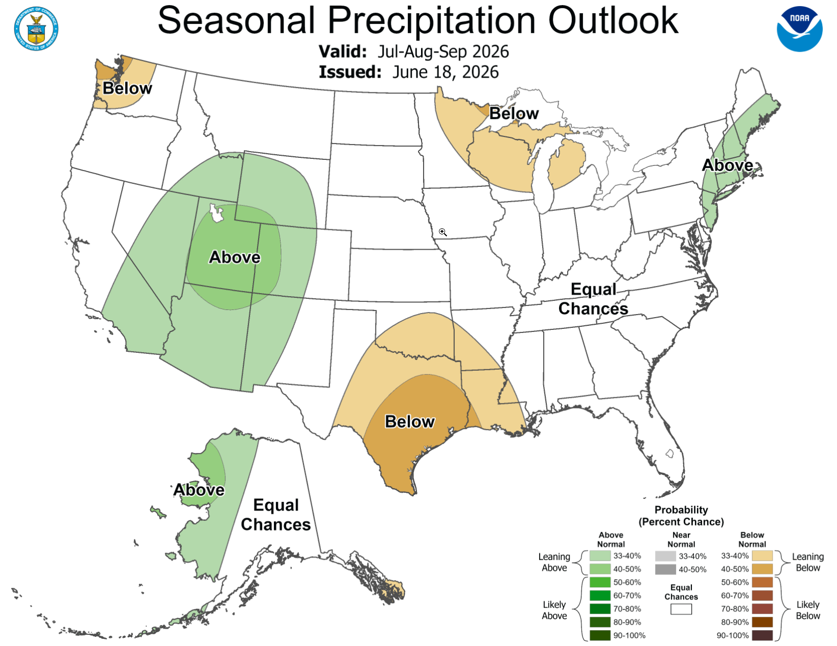
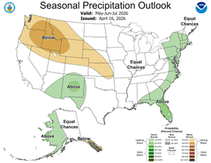
The end of April has brought heavy rainfall to a good 70% of the State. Springtime months are typically beneficial for Texas, bringing in showers that, unfortunately, pack a punch with severe weather attached.  Large Hail, Damaging Winds, Flash Flooding, and even Tornados are more common in March, April, and May, and will continue while our summertime heat and Hurricane season kick off.  More of this can be expected through May and stretching into the Mid-Summer months, according to NOAA’s 3-month outlook. This forecast keeps Texas in an Equal Chances Category through the early summer for marking near average on our rain gauges.  The forecast specifically mentions areas that have received rainfall in April, having better chances of finding more rain through early June due to the moistened topsoil.
Areas in far West Texas and far west of the Panhandle are in a slightly above-average chances category.  These equal and above probabilities are following our large-scale weather pattern, working to make a major shift.  Currently, we are in an ENSO Neutral period, meaning we are not in either La Niña or El Niño.  But as we move through May and June, we are expecting to move into the El Niño phase.  This will prompt better rain chances for all of the State, and typically reduces our likelihood of seeing hurricane impacts, although hurricanes in the Gulf and hitting Texas are still possible.

3-Month Temperature Outlook
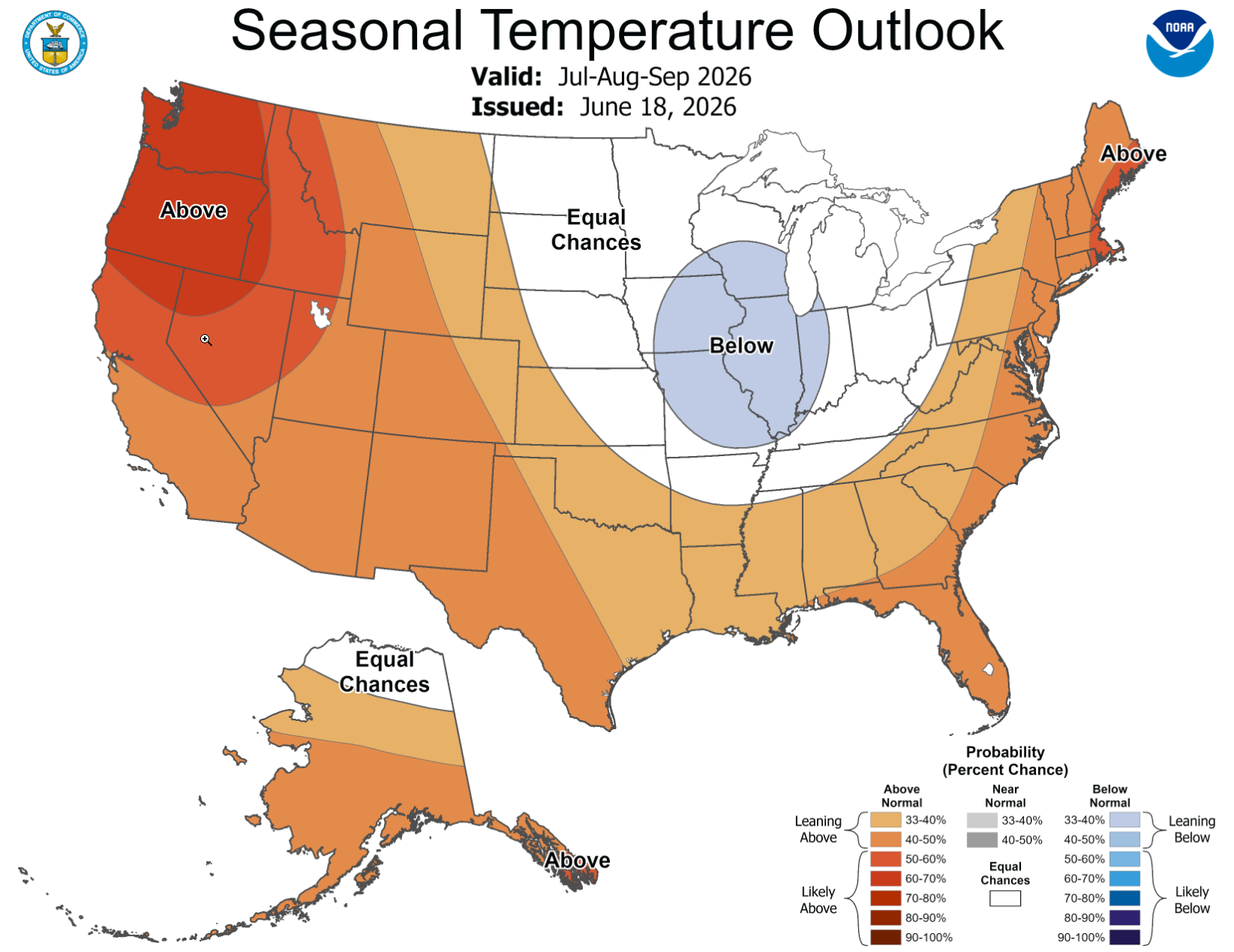
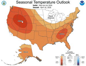
Summertime is here early.  All of Texas has a “Leaning Above” designation for hitting warmer-than-average temperatures through July.  Parts of Texas have already seen these warm summer temperatures and even heat advisories/warnings. With our increased moisture over the State, these warmer temperatures will feel more stifling.  It is important to remember to stay hydrated, take breaks in the shade, and make sure our livestock and pets have access to drinking water.  Practice summer weather-resistant strategies now; these warm temperatures are not going anywhere anytime soon.

Drought Update
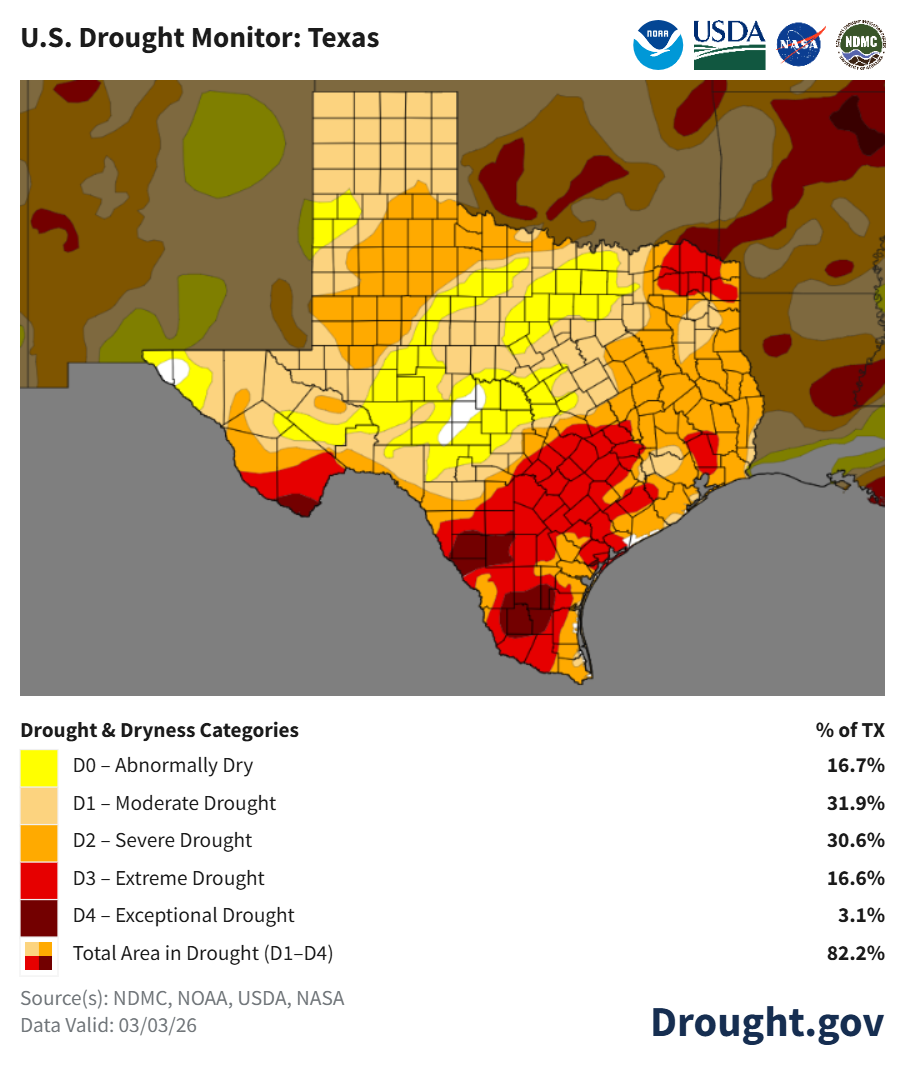
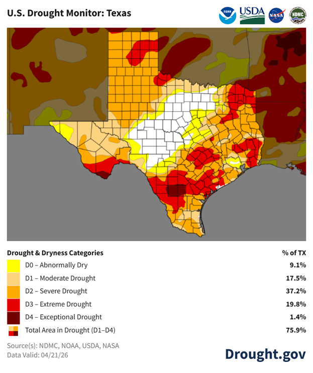
There is a tale of two stories this month since I last discussed drought with you all.  The Panhandle and Eastern parts of Texas have found drying, worsening conditions, and are currently under Severe and Extreme Drought. In the Northern Hill County, up through the DFW Metroplex, we have seen massive steps in a positive direction, as these areas are in no drought designation. This area is roughly 25% of the State of Texas and had been in the Dry to Severe Categories prior to this update. As of April 21st, around 60% of the State is in worse, Severe to Exceptional Drought categories.   Due to heavy rain since this map’s last update, 2-4 inches in the last 2 weeks, I expect to see areas around San Antonio and East along I-10 to North Houston get bumped down a drought category, and the total Severe to Exceptional percentage to go down. Far South Texas into the Valley should also see some lessening of the current extreme conditions they are in from rainfall in the last two weeks, 0.5-3 inches.

Recent forecasts and news calling for the early transition into a strong El Niño Pattern makes me believe that we will find some drought relief across much of the State over the next few months.  Strong El Niño patterns have previously provided heavy rainfall events that have helped to boost our water storage and ease drought conditions overall, but not totally erase them.  Along with higher chances of rain, stronger chances of severe weather and flash flooding will persist. Now is the time to make sure you and your operation are ready for adverse conditions.  Always have a way to receive weather warnings, have a plan, and practice that plan.  Let’s hope for beneficial rain without any of its rude partners, stay safe my friends.

References:
https://www.cpc.ncep.noaa.gov/
https://www.drought.gov/states/texas
Filed Under: El Niño, La Niña, Weather Tagged With: #Weather, drought, Drought Management, El Niño, La Nina

Spring Weather Outlook By Luke Drosche – Texas A&M AgriLife Extension DAR Specialist

March 18, 2026 by kara.matheney

West Texas Rangelands would like to extend our gratitude to Mr. Luke Drosche for collaborating with us and providing this weather update for our readers.  We thank him for sharing his time, talents, and knowledge with us as a guest contributor.  Luke serves with Texas A&M AgriLife Extension Service as a Disaster Assessment and Recovery Specialist.     

3-Month Precipitation Outlook:
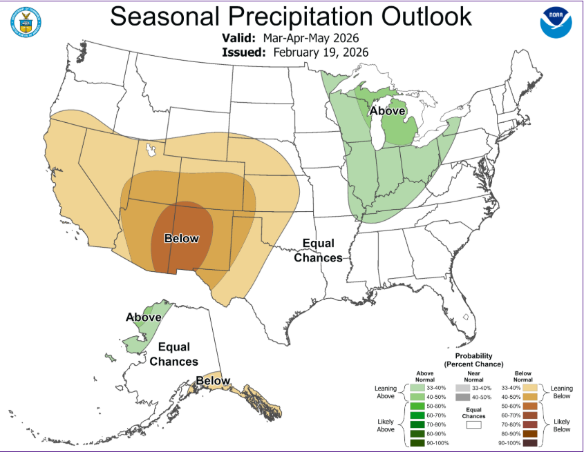
The first few days of March have brought areas of rain and severe storms to a large portion of the State. Those across the Coastal Plains have enjoyed some much-needed precipitation, while our areas in the Panhandle and out west have continue to be mostly dry with the exception of a few supercell thunderstorms. The month of March should continue to bolster higher rain chances before tapering back off closer to May. The 3-month outlook has shown that a majority of the state is in an “Equal Chances” Category for rain. Meaning that we are most likely to mark near normal on our rain gauges.  NOAA has predicated the month of March to be potentially wetter than average for the Northeastern part of the State before marking close to normal through April and May. While the far western and Northwestern areas are forecasted to be drier. This is the time of year we need to make sure we always have a way to receive weather warnings. Severe Weather in Texas is year-round but increases dramatically in the springtime. For anywhere you are in the State of Texas, all modes of Severe weather are possible. It is important to have a plan for you, your family, and your property should severe weather impact you. Know how to communicate, plan to live a few days without power or water, and who to contact if you are affected by severe weather.  Keep an eye to the sky.

3-Month Temperature Outlook:
Rinse and Repeat from our winter months is predicted as we remain warmer than average. March has a high likelihood of marking above normal temperature with higher-than-normal temperatures likely through at least May, areas out west have higher potential to be warmer than average.  The entire state is under this prediction due to our current La Nina Conditions. These bring warmer temperatures to our area. However, we are seeing a transition out of La Nina into ENSO Neutral Conditions. This transition will happen over the next few months. Later in the year we look to potentially move into an El Nino weather pattern closer to next Fall. We will take this as a hope for more beneficial rain as 19.2 million of us in the State of Texas are in a Drought Designation.


Drought Update:
Extreme Drought Conditions persist in Central and South Texas with nearly the entire state in some dryness/drought category.  Panhandle regions remain in Moderate Drought and areas slightly south of there creep into the Severe Drought Designation. Early March’s rain will provide some relief to the Coastal Plains and parts of Central Texas when the next Drought updates come in roughly a month from now. More rainy days are predicted through March and will hopefully continue to improve conditions.  The next few months, March, April, and May typically bring weather systems across much of the state.  These systems pack a punch with severe storms and high rainfall rates.  We always prefer longer, drawn out rainfall events that allow the rainfall to soak into the soil, rather than run off the dry, packed ground. However, once the soil is primed with some moisture from whatever form of rain we get, we benefit more.  With the transition predicted us of La Nina and into ENSO Neutral conditions, we are hopeful for some improvement in overall drought conditions across the State.  Over many months in recent history, we have been in a La Nina designation, which is what has continued to push our drought conditions.  As we transition into Neutral Conditions in the short term, we will see more weather patterns indicative of repeated rainfall come into play.  No doubt we will still see long periods of dry weather, but let’s keep a hopeful eye on next fall as we should move into El Nino Conditions.


References and Resources: https://www.cpc.ncep.noaa.gov/, https://www.drought.gov/states/texas
Filed Under: Conservation, El Niño, La Niña, Uncategorized, Water, Weather Tagged With: #AgrliLifeExtension, #ClimateVariability, #ConservationConversations, #Weather, #WestTexasRangelands, drought

A Flood of Change: What July’s Historic Rains Mean for Texas’ Drought Outlook

August 27, 2025 by jaime.sanford

Texas endured a dramatic climatic shift in July—one that’s already rewriting the story of our drought and breaking 131 year records. But even as optimism swells, persistent vulnerabilities remind us the path to recovery is far from over.

[Read more…] about A Flood of Change: What July’s Historic Rains Mean for Texas’ Drought Outlook

Filed Under: Drought Management, El Niño, Weather

81% La Niña Conditions

October 16, 2024 by jaime.sanford

Pockets of drought relief exist, but not much.  In fact, 74% of the state is abnormally dry or worse, up 4% from last month. Underlying dryness and dry, drought cured grasses will support low to moderate potential for wildfires with steady 10-15 mph winds as frontal activity increases. As forage transitions to fuel, rangeland managers are monitoring perennial grass response throughout the Concho Valley as some counties received over 12” of rainfall in September alone.     

As we move from a summer to fall-like pattern this week, the Outlook +Water Report from October 5th keenly acknowledges sea-surface temperatures in the Central Pacific (defining the status of the weather phenomenon known as the El Niño Southern Oscillation) are under neutral conditions, but sea-surface temps continue to drop suggesting a transition to La Niña conditions in September-November (81% chance). However, current dynamical and statistical models show the La Niña period promises to be weak and short.


Source


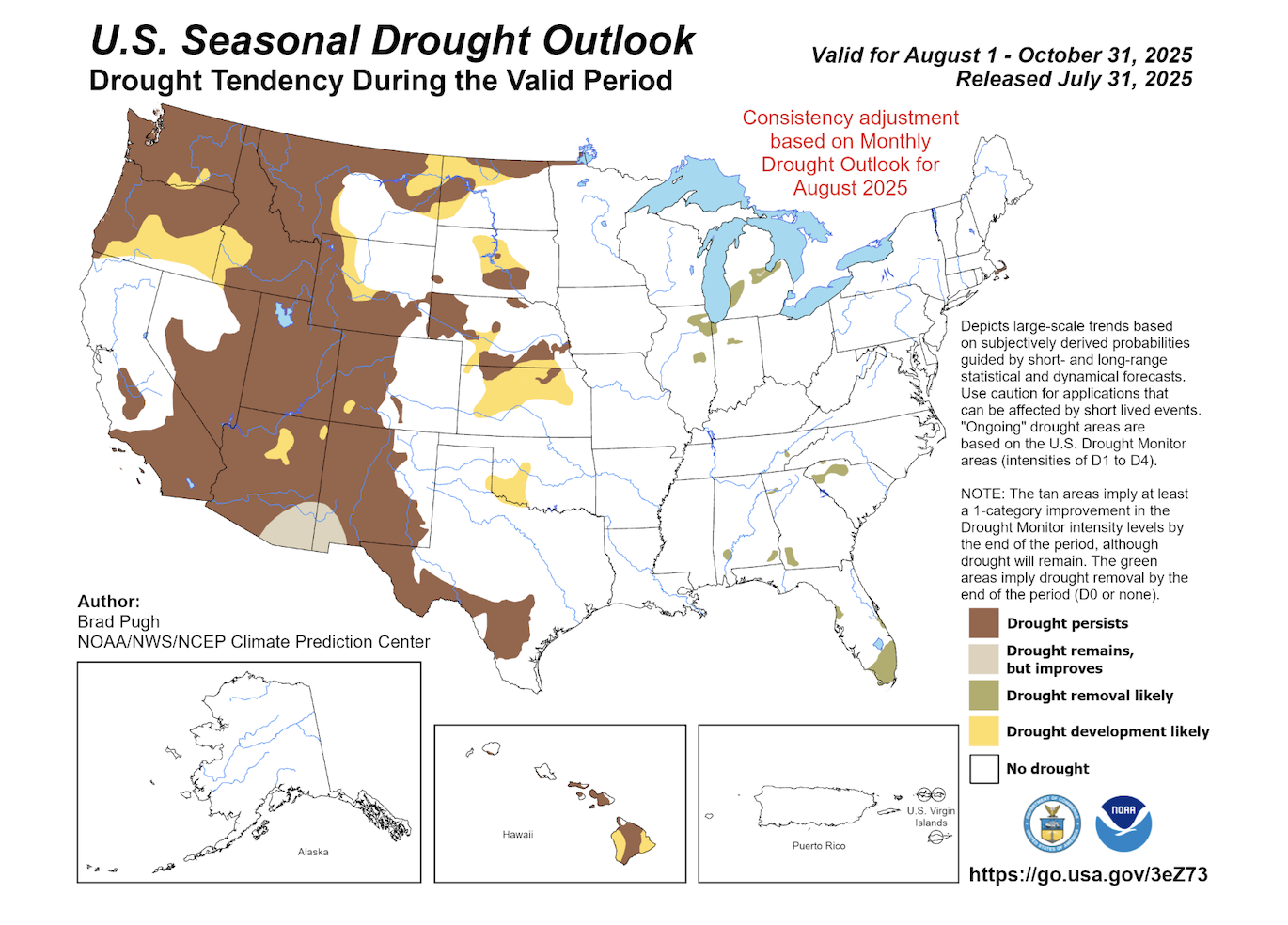
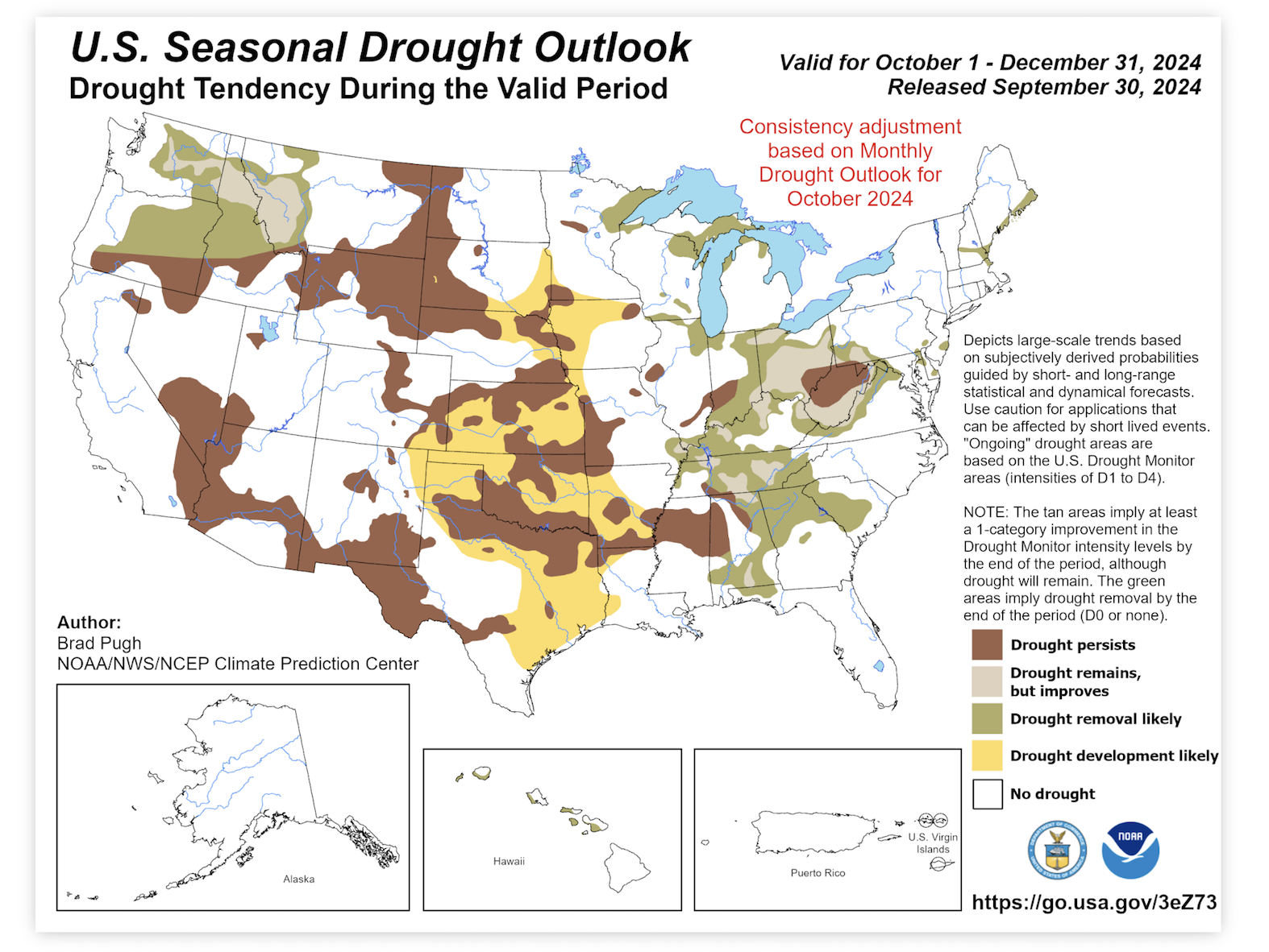
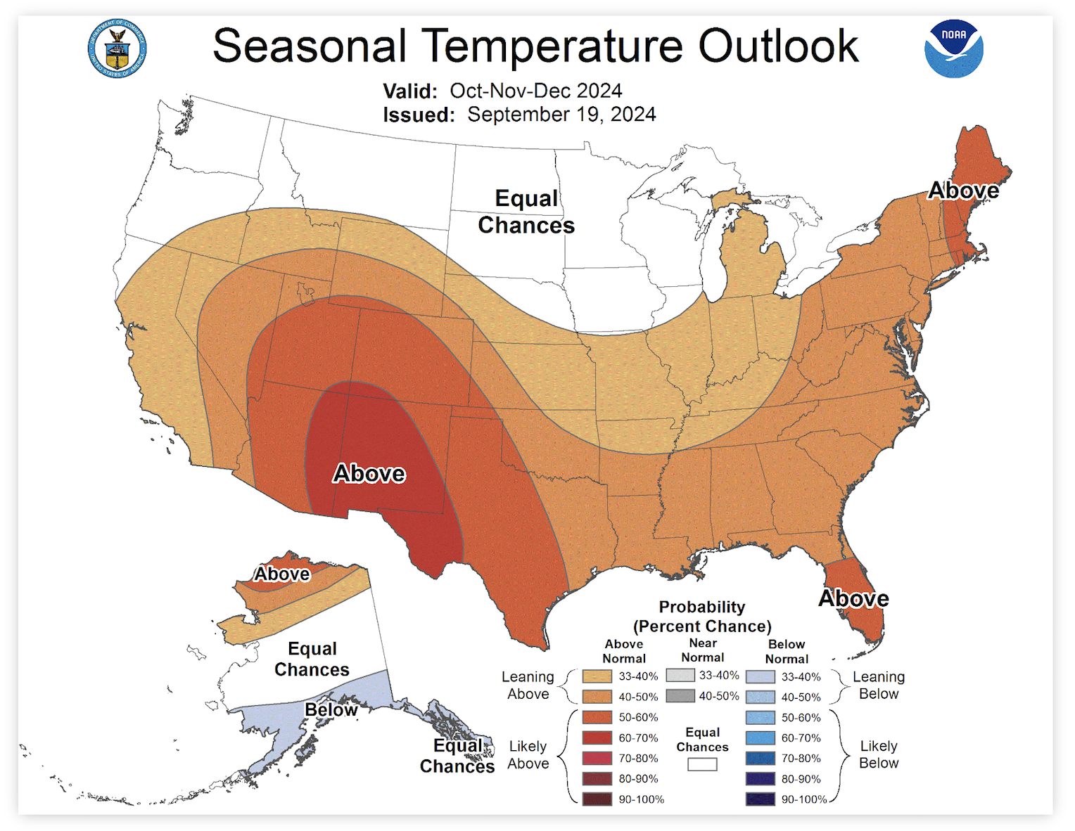
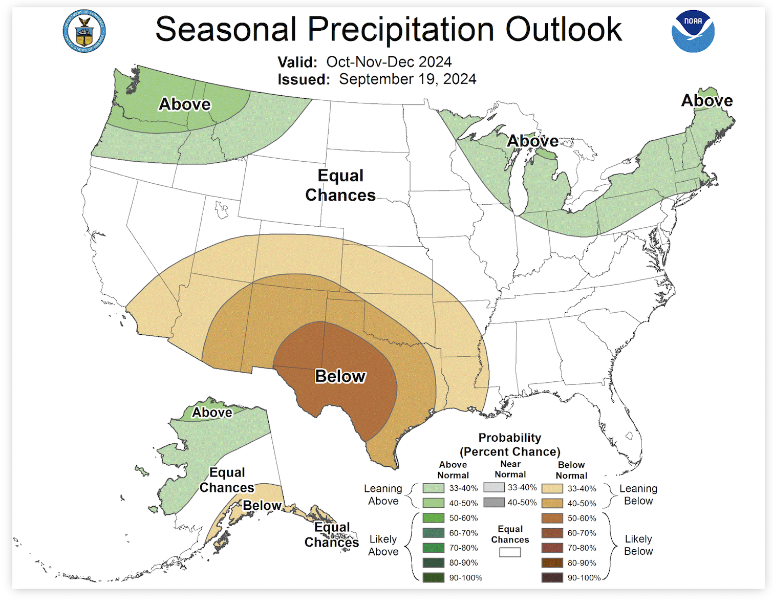
The current U.S. Seasonal Drought Outlook shows drought development over the eastern third of Texas and in the Panhandle.  With the increased drought designation, temperatures over the next 3 months are expected to be above-average with rainfall deficits for Far West, Panhandle, and Eastern Texas.    


Source


Source


Source


As with any drought monitoring or transitions into La Niña this fall and winter, West Texas Rangeland managers know to prioritize keeping the ground covered, maintaining residual forage, rotating livestock, and plan, plan, plan.   


For more information, be sure to check out the full article from Outlook + Water here!


Mace, R. (2024, October 8). outlook+water: Drought declines, La Niña delayed again, more drought expected. texaspluswater.wp.txstate.edu. October 14, 2024, https://texaspluswater.wp.txstate.edu/2024/10/08/outlookwater-drought-declines-la-nina-delayed-again-more-drought-expected/?utm_source=Texas%2BWater+Newsletter&utm_campaign=c569d9ca52-EMAIL_CAMPAIGN_2023_03_22_08_02_COPY_01&utm_medium=email&utm_term=0_-86323a7a46-%5BLIST_EMAIL_ID%5D&mc_cid=c569d9ca52&mc_eid=23994de06b

Filed Under: El Niño, La Niña

Drought Update!

August 21, 2024 by jaime.sanford

Did you know that East and Northeast Texas received two to four times the normal amount of rainfall in July? Unfortunately, the other half of the State did not do as well, as some places in West Texas only received a half an inch of rain. With the increase in rains in Eastern areas of the State, Lake Travis saw 78,000 acre-feet of runoff pour into the basin! Even with that amount of runoff, Lake Travis still remains at less than 50% full. The figure below shows the reservoir storage for Lake Travis. In looking at the figure, our numbers are above where we were for 2023 and a little bit more than where we were in 2011. 

La Niña has been the dominant subject of the summer. According to this month’s update, projections are suggesting a shift to La Nina in mid-to-late summer. Looking at the figure below, there is a 45% chance that La Nina occurs during the July-August-September months. Moving ahead on the figure, we can see that shifting one month over, there is a 70% chance of those La Niña conditions occurring in August-September-October months. 


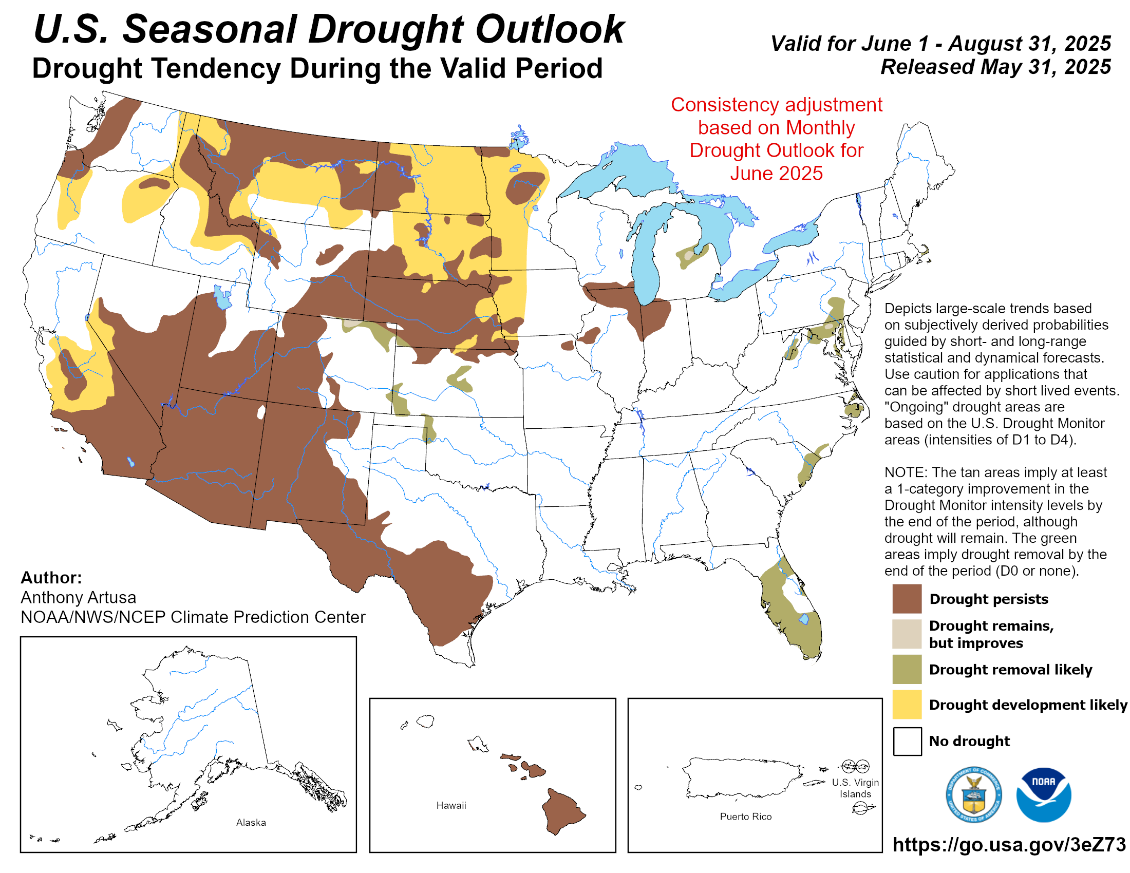
Looking ahead at the three month drought outlook, you can see in the figure below, that West Texas will remain in drought conditions. There is also the possibility for drought conditions to develop in the Northern Panhandle. 


In looking at the 3-month precipitation forecast, Texas does not look to be receiving a greater chance of rain. As you can see, the East Coast is set to have above normal chances of rain, with East Texas catching a tail end of that wave. On the other side of that, the Northern Panhandle is forecasted to receive less than normal rainfall. The figure below explains more of the 3-month forecast. 


For more information, be sure to check out the full article here from Texas+Water.

Filed Under: El Niño, La Niña, Weather

Texas + Water – June Update

June 26, 2024 by jaime.sanford

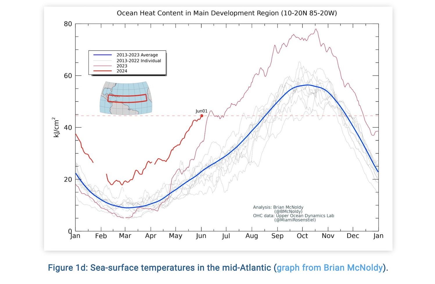
Hurricane season is coming fast and furious! NOAA is predicting an above-normal hurricane season, forecasting 17 – 25 named storms (winds higher than 39 mph), 8-13 hurricanes (winds of 74 mph or higher) and 4-7 major hurricanes (Cats 3, 4, or 5 with winds of 111 mph or higher). The sea-surface temperatures are already exceeding last year’s temperatures. The figure above shows the differences in temperatures from this year and previous years.  With all this in mind, NOAA is predicting an 85% above-normal season. The season stretches from June 1st – November 30th. 

[Read more…] about Texas + Water – June Update

Filed Under: Drought Management, El Niño, La Niña, Weather

Monthly Weather Update!

April 17, 2024 by jaime.sanford

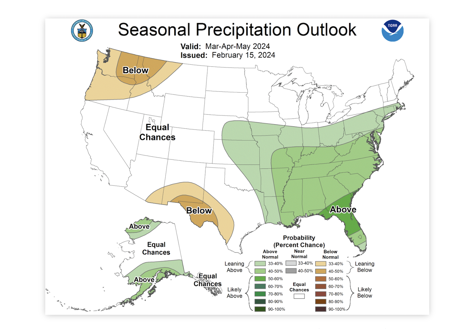
The U.S. Seasonal Drought Outlook was recently released for the next three months. According to the update released on March 31st, drought will persist in West Texas and with some improvements in the Hill Country area. The precipitation forecast will not help as the next three months is forecasted to be lower than normal rain chances while the very East side of the State will receive higher than normal rain chances. In Texas, 45% of the State is abnormally dry or worse, this has increased 2% from last month.   

[Read more…] about Monthly Weather Update!

Filed Under: El Niño, La Niña, Weather

Drought Conditions Persist and a Weather Update!

March 13, 2024 by jaime.sanford

Over the last month the Eastern part of the State has received significant amounts of rainfall, while the Western part of the State is below average. Over the next three months, see figure adjacent, it is predicted that the Western part of the State, which is already dry, will be experiencing even drier than average conditions. 


[Read more…] about Drought Conditions Persist and a Weather Update!

Filed Under: El Niño, La Niña, Weather

What does a strong La Niña this summer mean for Texas weather?

February 28, 2024 by jaime.sanford

During this Winter season, parts of Texas have experienced a strong El Niño presence. However, El Niño has begun to weaken and is expected to do so over the next few months. El Niño’s counterpart, La Niña, is likely to take over as early as this summer. According to the Climate Prediction Center, there is a 55% chance of La Niña conditions by June 1st. 

[Read more…] about What does a strong La Niña this summer mean for Texas weather?

Filed Under: El Niño, La Niña, Weather

Monthly Drought and Weather Update!

December 6, 2023 by jaime.sanford

In the past two months, East Texas and the Coast have seen more than two inches of rain. However, the Southern Coastal area and the Northeastern area of Texas have received more than four inches of rain. Far West Texas and the Panhandle have received less than .5 of an inch of rain, coinciding with most of the rest of the state that have received less than normal rainfall over the past thirty days. 

[Read more…] about Monthly Drought and Weather Update!

Filed Under: El Niño, Weather

  • Page 1
  • Page 2
  • Go to Next Page »

Recent Posts

  • 2025 Region 3 Texas Land Value Trends: What Stability Means for West Texas Producers
  • A Tale of Two Texas Landscapes: Drought Conditions and the Road Ahead
  • The Hidden Cost of Overgrazing: How It Drains Your Watershed, Your Rainfall, and Your Bottom Line
  • Economic Incentives for Reducing Wildfire Risk
  • Building Knowledge and Confidence with the Updated Online Prescribed Burn School

Categories

  • 4-H Range Contests
  • Beef Cattle
  • Brush Management
  • Carbon Credits
  • Carbon Markets
  • Conservation
  • Conservation Practices
  • Drought Management
  • El Niño
  • Events
  • Goats
  • Grazing Management
  • La Niña
  • Land
  • Lessons Learned
  • Meet A County Extension Agent
  • Plant ID
  • Podcast
  • Prescribed Burn Associations
  • Prescribed Burning
  • Publications
  • Range Concepts
  • RAP
  • Sheep
  • Society for Range Management
  • Soil
  • Staff
  • Targeted Grazing
  • Uncategorized
  • Water
  • Weather
  • Why I Ranch
  • Wild Pigs
  • Wildfire
  • Wildfires
  • Wind
  • Woody Encroachment
  • Youth Range Workshop

Archives

Texas A&M AgriLife Extension Service
Texas A&M University System Member
  • Compact with Texans
  • Privacy and Security
  • Accessibility Policy
  • State Link Policy
  • Statewide Search
  • Veterans Benefits
  • Military Families
  • Risk, Fraud & Misconduct Hotline
  • Texas Homeland Security
  • Texas Veteran's Portal
  • Equal Opportunity
  • Open Records/Public Information