West Texas Rangelands would like to extend our gratitude to Mr. Luke Drosche for collaborating with us and providing this weather update for our readers. We thank him for sharing his time, talents, and knowledge with us as a guest contributor. Luke serves with Texas A&M AgriLife Extension Service as a Disaster Assessment and Recovery Specialist.

3-Month Precipitation Outlook
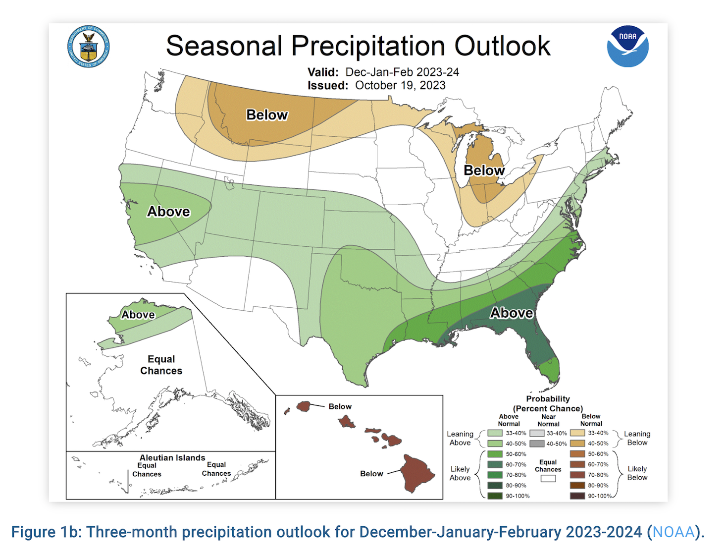
Heavy Rainfall is always two-sided. This month we have seen extremely high rainfall totals across the Hill Country. All of that rain flows into the Highland Lakes, Choke Canyon, Lake Corpus Christi, and Canyon Lake. These lakes needed a boost, especially those down in South Texas near Corpus Christi. While providing necessary drinking water, unfortunately, this extreme event took multiple lives and has cost Texas millions of dollars. To those who are tired of the rain, the next 3 months are expected to be slightly drier than what we have recently experienced. Most of the state is in a “Leaning Below” category while El Paso sits in a rare “Leaning Above” category. They are more likely to see some rain. Both categories are in slight chances, meaning there is less likelihood of deviation from the typical early fall precipitation.
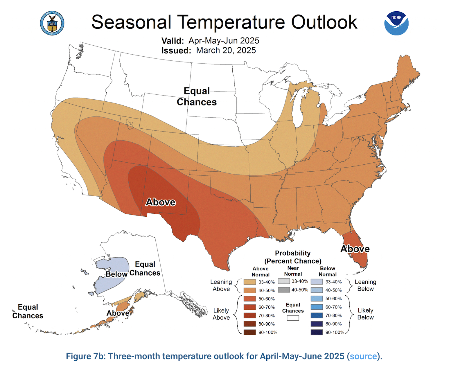
3-Month Temperature Outlook
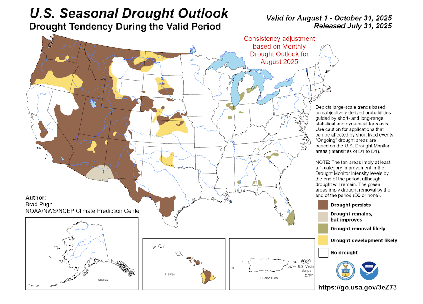
While rainfall chances sit in the middle, our temperature predictions are confident. That’s right, hot. It is near August in Texas, and here we are seeing extreme heat across our state. Nothing new for the majority of us, who have understood what the late dog days of summer typically bring. NOAA also understands this, as all of the state is in a Higher-than-Average category for summertime temperatures. We will need to watch areas that have high fuel loads from previous rains and remaining grasses, as the expedited drying will create dangerous fire weather conditions across the State.
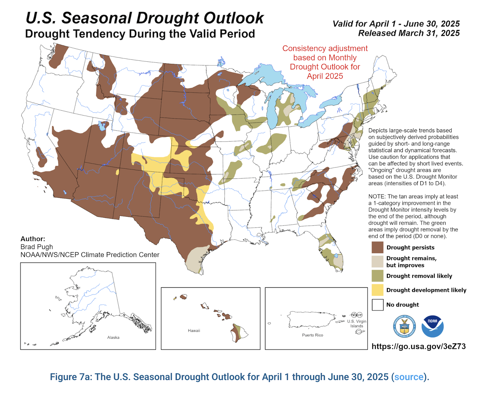
Drought Update
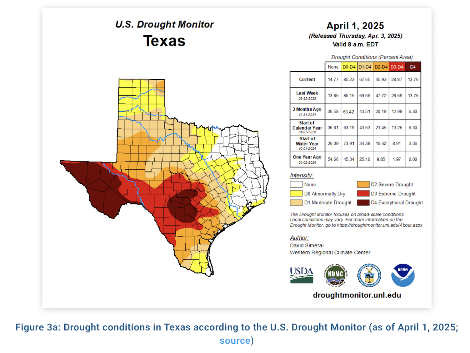
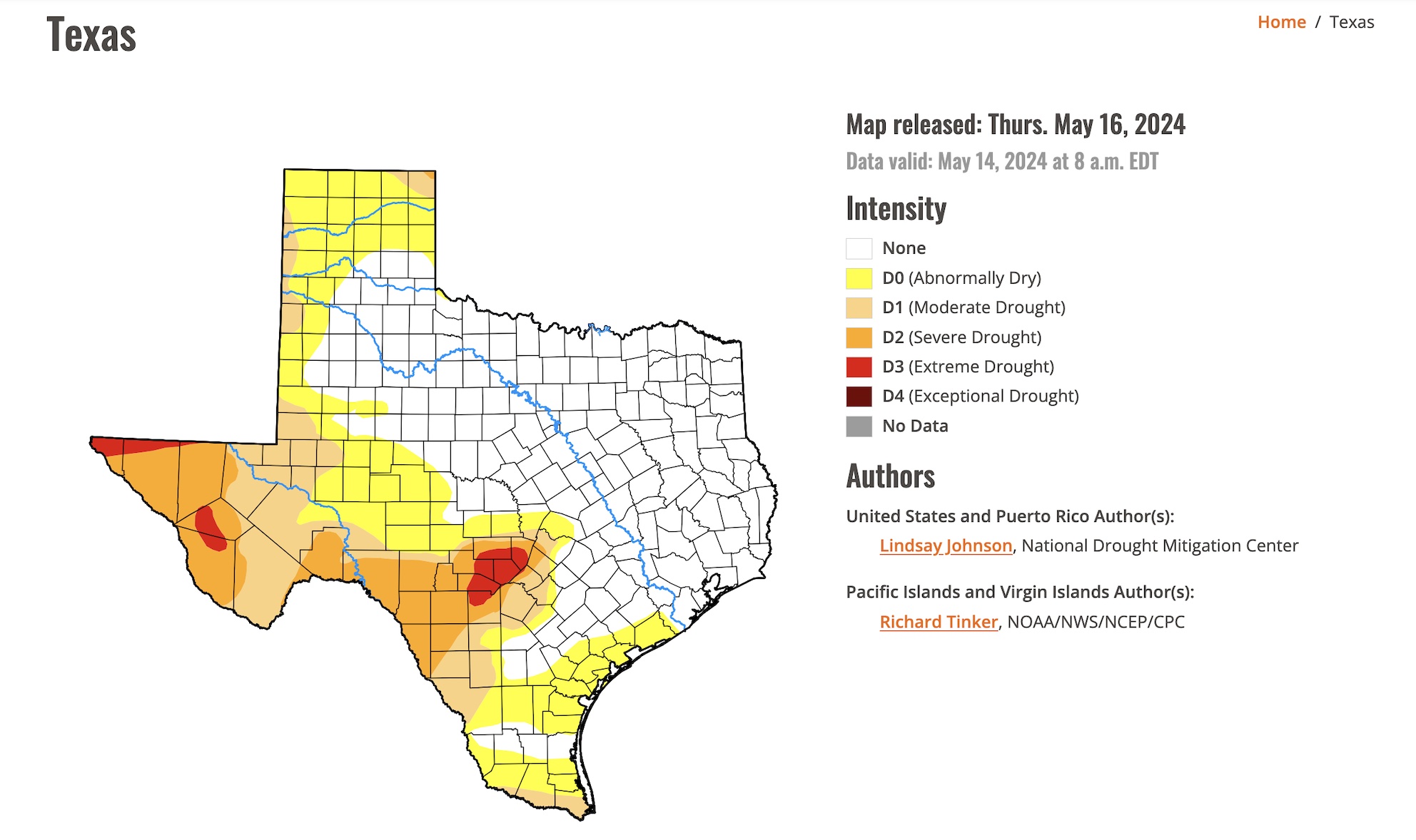
We have seen continued improvements in the Hill Country, Northeast, and in West Texas with recent rainfall. Some light improvements have also found the panhandle with areas of extreme drought shrinking down to 1% rather than 4% from last update. The Panhandle still needs more rainfall to find further relief before stifling summer temperatures bake the moisture from the ground. It is also important to note increasing areas of Abnormally Dry Conditions down in Deep South Texas. We hope to see moderate rainfall amounts for those of us still in drought, especially in the Panhandle and along/East of I-35, and a break from rain for those in the Hill Country areas.

Hurricane Season
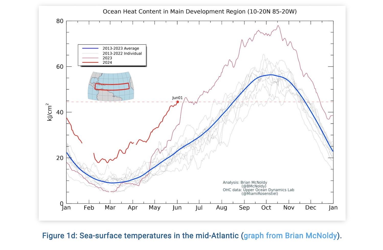
Last week we got our first true taste of the Tropical Weather Season. Tropical Storm Bertha gave some Texans a scare when its track took a southward shift and hung out over warm Gulf Waters. Luckily, it did not carry any major impacts to Texas, but it served as a wake-up call for all of us that we are still in Hurricane Season and to check our Hurricane Preparedness Plan. Hurricane Season in Texas is officially June 1st through November 30th. The US has seen hurricanes on either side of those dates. For us, our hurricanes come from the Atlantic Basin. Hurricanes in the Gulf are also categorized under the Atlantic Basin Title. This area sees hurricanes throughout the entirety of hurricane season, but we are more likely to experience these between August 1st and November 15th. Our waters warm all through the summer and become energy powerhouses for anything that forms in the early fall. Texas has seen some of its worst storms in the early fall, such as Hurricane Harvey in 2017. Make a plan, stay informed, and stay prepared for Hurricanes and any disaster.

Resources and References
*https://www.cpc.ncep.noaa.gov/
*https://www.drought.gov/states/texas