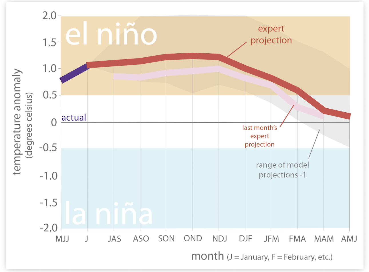
 The last three years have been years of La Niñas, while there is some chatter of a super El Niño coming, right now there is a 71 % chance of a strong El Niño developing (defined as a sea-surface temperature greater than or equal to 1.5 degrees Celsius). Figure 6a illustrates El Niño conditions exceeding 95% chance of extending through the winter, with growing chances of more neutral conditions in early Spring 2024.
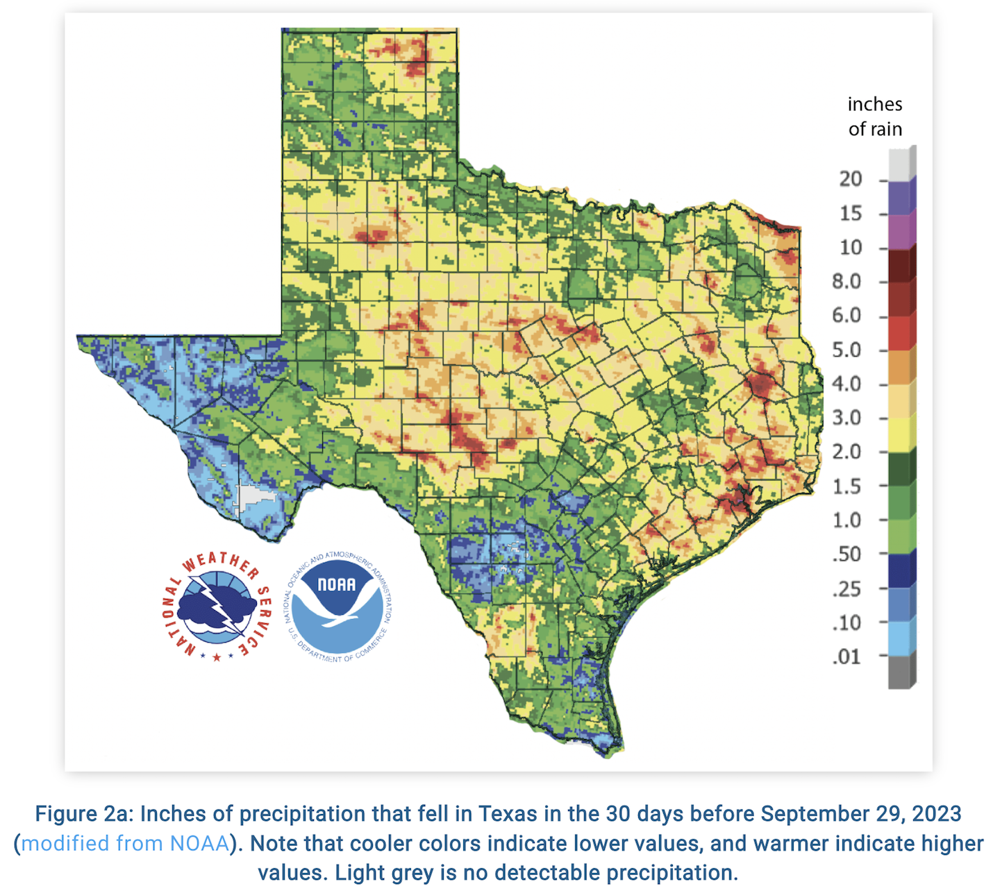
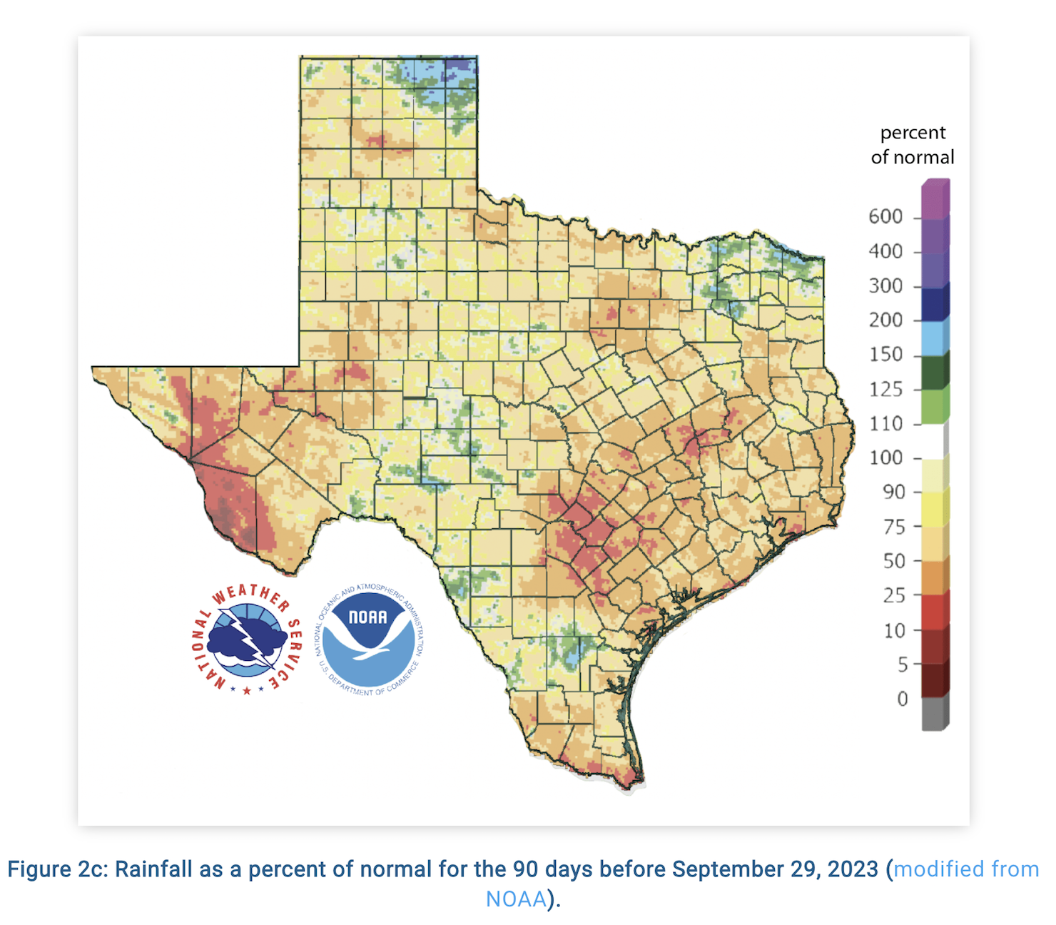
In the past few weeks, we have seen some storms roll through and some slightly cooler temperatures coming in from the North towards the Center of the State. Despite that, most of the state has received less than normal rainfall over the past 30 days, based on September 29, 2023 data (Figure 2a). In addition, most of Texas are below normal amounts of rainfall with significant deficits in rainfall for the last 90 days (Figure 2c).
In summary, 96% of Texas is abnormally dry or worse. This pattern has not changed in the last five weeks. While there were more recent rains in the last week, the latest drought update will be available on Thursday the 12th and will hopefully reveal some average fall precipitation scattered across the Edwards Plateau and Hill Country.
For more information on the monthly drought update, be sure to read the full article here.
For weekly drought updates, be sure to following our social media accounts here!.

