• Skip to primary navigation
  • Skip to main content
  • Skip to primary sidebar
  • Texas A&M Forest Service
  • Texas A&M Veterinary Medical Diagnostics Laboratory
  • Texas A&M AgriLife Extension Service
  • Texas A&M AgriLife Research
  • Texas A&M College of Agrculture and Life Sciences
West Texas Rangelands
West Texas RangelandsWe hope to provide a variety of science-based rangeland information and current research on prescribed fire, wildfires, brush management, and grazing management!
  • Menu
  • Home
  • About & Contact
  • Publications
    • Extension Publications
    • Refereed Journal Articles
    • Program Summaries
  • Events
  • Lunch N’ Learn
  • Infographics
    • Drought
    • Grazing
    • Herbicide
    • Prescribed Fire
    • Rangeland Plants
    • Wildfire
  • Range Resources
    • Published to Pasture
    • Range Concepts
  • Fire Resources
  • Sponsors
  • AgriLife Learn Online Courses

Earth Map

May 15, 2024 by jaime.sanford

Have you heard of Earth Map or seen the capabilities it holds?

Earth Map is a point-and-click cloud-based platform powered by Google Earth Engine and other free data sources without any need for coding. Earth Map enables any user to visualize, analyze, and monitor changes on Earth’s surface, performing multi-temporal and multi-parametric land monitoring, climate assessments and other geospatial and Earth Observation-based analyses. 


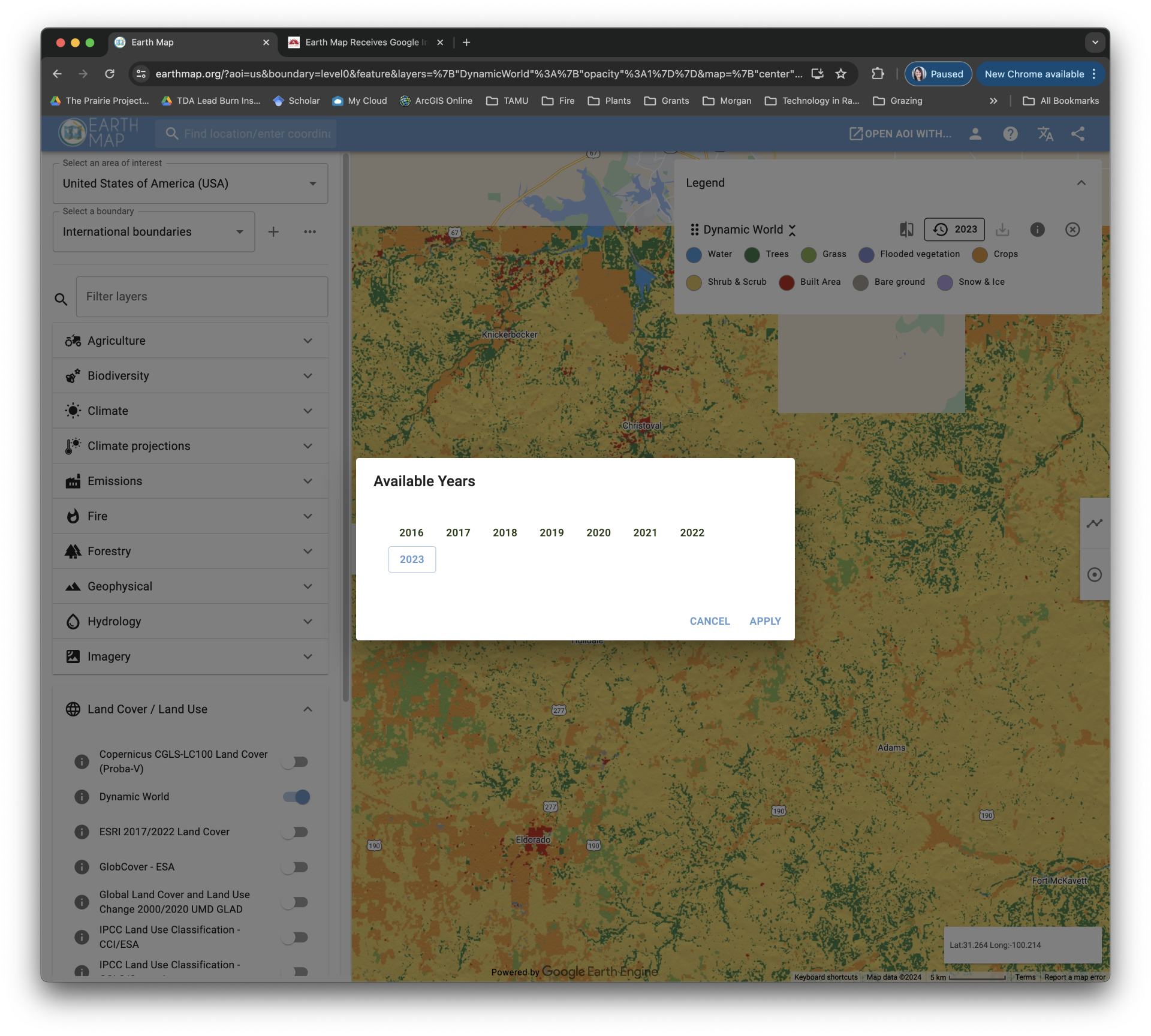
Check out the land cover features, particularly the Dynamic World layer, which is a near realtime 10m resolution global land use land cover dataset, produced using deep learning, freely available and openly licensed. It is the result of a partnership between Google and the World Resources Institute, to produce a dynamic dataset of the physical material on the surface of the Earth. Dynamic World is intended to be used as a data product for users to add custom rules with which to assign final class values, producing derivative land cover maps. Using a novel deep learning approach, based on Sentinel-2 Top of Atmosphere, Dynamic World offers global land cover updating every 2-5 days depending on location. The maps shown in Earth Map represent a yearly averaging of the observations available in one year.

For more information be sure to check out the website here! Sign in or join anonymously and dive into all the wonderful features this website has to offer.  


Filed Under: Conservation Practices, Grazing Management, Range Concepts

Recent Posts

  • Fire Up Plant Diversity!
  • New Publication! Photosensitization
  • Dry, Warm, Windy, and Fuel.
  • Lessons Learned – Pyro-Vortex Tornado on the Deer Creek Fire
  • Mapping Fire Before It Starts: How the Fireshed Project Strengthens Readiness in West Texas

Categories

  • 4-H Range Contests
  • Beef Cattle
  • Brush Management
  • Carbon Credits
  • Carbon Markets
  • Conservation
  • Conservation Practices
  • Drought Management
  • El Niño
  • Events
  • Goats
  • Grazing Management
  • La Niña
  • Land
  • Lessons Learned
  • Meet A County Extension Agent
  • Plant ID
  • Podcast
  • Prescribed Burn Associations
  • Prescribed Burning
  • Publications
  • Range Concepts
  • RAP
  • Sheep
  • Society for Range Management
  • Soil
  • Staff
  • Targeted Grazing
  • Uncategorized
  • Water
  • Weather
  • Why I Ranch
  • Wild Pigs
  • Wildfire
  • Wildfires
  • Wind
  • Woody Encroachment
  • Youth Range Workshop

Archives

Texas A&M AgriLife Extension Service
Texas A&M University System Member
  • Compact with Texans
  • Privacy and Security
  • Accessibility Policy
  • State Link Policy
  • Statewide Search
  • Veterans Benefits
  • Military Families
  • Risk, Fraud & Misconduct Hotline
  • Texas Homeland Security
  • Texas Veteran's Portal
  • Equal Opportunity
  • Open Records/Public Information