The 85th Legislative Session brought an amendment to the law related to use of unmanned aircraft in Texas. Importantly for agriculture, the amendment adds confined animal feeding operations (“CAFOs”) to the list of “critical infrastructure” facilities to which additional flight limitations apply for many drone operators. The amendment will go into effect on September 1, 2017.
This post will review, in detail, the current Use of Unmanned Aircraft statute and discuss the most recent amendment. For those of you not concerned with the specific details, the “Take Away Points” sections at the end of the post will summarize the key points of the post and save you some time.
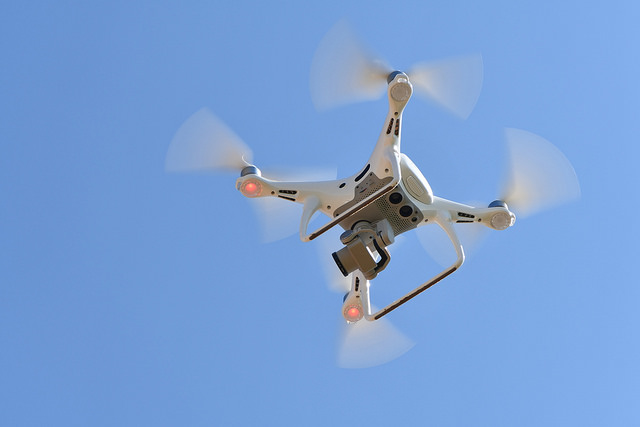
TAMU Agrilife Extension photo by Kay Ledbetter
Background
In 2013, Texas passed the Use of Unmanned Aircraft statute (Texas Government Code 423) to address concerns related to drones and privacy issues. The statute addresses only unmanned aircraft being used to capture an “image.” An image is defined as “any capturing of sound waves, thermal, infrared, ultraviolet, visible light, or other electromagnetic waves, odor, or other conditions existing on or about real property in this state or an individual on that real property.” The statute does not appear to protect individuals from drones that may be flying over property but not capturing images.
Overview of the Statute
Under the Act, there are certain drone uses that are deemed legal and others that are prohibited.
Lawful drone uses:
It is lawful to capture an image using an unmanned aircraft if:
(1) it is for the purpose of professional or scholarly research or academic purpose by a person acting on behalf of an institution of higher education;
(2) in airspace designated as a test range by the FAA;
(3) as part of a United States military operation;
(4) if the image is captured by a satellite for the purpose of mapping;
(5) if the image is captured by or for an electric or natural gas utility for operations, maintenance, inspection, assessing vegetative growth, or routing and siting;
(6) with the consent of the individual who owns or lawfully occupies the real property captured in the image;
(7) pursuant to a valid search warrant;
(8) if the image is captured under limited circumstances related to investigations or pursuits by a law enforcement authority or a person who is under contract or acting on behalf of a law enforcement authority;
(9) if the image is captured by state or local law enforcement authorities or persons acting on their behalf for the purpose of surveying the scene of a catastrophe to determine if a state of emergency should be declared, to preserve public safety, protect property, or survey damage, or to conduct routine air quality sampling;
(10) at the scene of a spill or suspected spill of hazardous materials;
(11) for the purpose of fire suppression;
(12) for the purpose of rescuing a person whose life or well-being is in imminent danger;
(13) if the image is captured by a Texas licensed real estate broker in connection with the marketing, sale, or financing of real property, provided that no individual is identifiable in the image;
(14) of real property or a person on real property that is within 25 miles of the United States border;
(15) from a height not more than 8′ above the ground level in a public place, if the image was captured without using any electronic, mechanical, or other means to amplify the image beyond normal human perception;
(16) of public real property or a person on that property;
(17) if the image is captured by the owner or operator of an oil, gas, water or other pipeline for the purpose of inspecting, maintaining, or repairing pipelines and other facilities without the intent to conduct surveillance on an individual or real property;
(18) in connection with oil pipeline safety and rig protection;
(19) in connection with port authority surveillance and security;
(20) if the image is captured by a registered professional land surveyor in connection with the practice of professional surveying, provided that no individual is identifiable in the image; and
(21) if the image is captured by a licensed professional engineer in connection with the practice of engineering, provided that no individual is identifiable in the image.
Unlawful to conduct surveillance:
Under Section 423.003, it is unlawful to capture an image using an unmanned aircraft if the image is of an individual or privately owned property in this state with the intent to conduct surveillance on the individual or property captured in the image. “Intent” under this statute has the same definition as under the Texas Penal Code: “A person acts intentionally, or with intent, with respect to the nature of his conduct or to a result of his conduct when it is his conscious objective or desire to engage in the conduct or cause the result.”
It is a defense under this statute if a person captures an image, but destroys it as soon as the person has knowledge that the image was captured in violation of this statute and the person did not disclose, display, or distribute the image to a third party.
A person who violates this portion of the statute is guilty of a Class C misdemeanor, which can result in a criminal fine of up to $500.
Additionally, the owner or tenant of real property may bring a civil action against the violator to obtain an injunction, recover a civil penalty of $5,000 for all images captured in a single violation, and recover court costs and attorney’s fees. Civil suit must be brought within 2 years of the image being captured.
Unlawful use of image:
It is unlawful to capture an image in violation of Section 423.003 and possess, disclose, display, distribute, or otherwise use that image.
A person who possesses this image is guilty of a Class C misdemeanor, which can result in a fine of up to $500. A person who discloses, displays, distributes, or otherwise uses the image is guilty of a Class B misdemeanor. Persons convicted of a Class B misdemeanor can face up to 180 days in jail and up to a $2,000 fine.
It is a defense under this statute if a person captures an image, but destroyed it as soon as the person had knowledge that the image was captured in violation of this statute and if the person stopped disclosing, displaying, distributing, or otherwise using the image as soon as the person had knowledge that the image was captured in violation of Section 423.003.
Additionally, the owner or tenant of real property may bring a civil action against the violator to obtain an injunction, recover a civil penalty of $10,000 for disclosure, display, distribution, or other use of any images captured in violation of this statute, recover actual damages if the person who captured the image acted with malice, and recover court costs and attorney’s fees. Civil suit must be brought within 2 years of the image being initially disclosed, displayed, distributed or otherwise used in violation of this portion of the statute.
Unlawful use of unmanned aircraft over critical infrastructure facility:
It is unlawful to intentionally or knowingly:
(a) operate a drone over a critical infrastructure facility lower than 400′ above ground level;
(b) allow a drone to make contact with a critical infrastructure facility, including a person or object on the premises of or within a facility; or
(c) allow a drone to come within a distance of a critical infrastructure facility that is close enough to interfere with the operation of or cause disturbance to the facility.
Importantly, a “critical infrastructure facility” includes the following, if completely enclosed by a fence or other physical barrier that is obviously designed to exclude intruders or if clearly marked with posted signs that indicate entry is forbidden and are reasonably likely to come to the attention of intruders:
(i) a petroleum or alumina refinery;
(ii) an electrical power generating facility, substation, switching station, or electrical control center;
(iii) a chemical, ploymer, or rubber manufacturing plant;
(iv) a water intake structure, water treatment facility, wastewater treatment plant, or pump station;
(v) a natural gas compressor station;
(vi) a liquid natural gas terminal or storage facility;
(vii) a telecommunications central switching office;
(viii) a port, railway switching yard, trucking terminal, or other freight transportation facility;
(ix) a gas processing plant, including plants used to process, treat, or fractionation natural gas;
(x) a transmission facility used by a federally licensed radio or television station;
(xi) a steelmaking facility that uses an electric arc furnace to make steel; or
(xii) a dam classified as a high hazard by TCEQ.
Also included are any portion of an above ground oil, gas, or chemical pipeline that is enclosed by a fence or other physical barrier obviously designed to exclude intruders.
These flight limitations in this portion of the statute do not apply to the following persons:
(a) the federal or state government or governmental entity or person under contract with or otherwise acting under the direction or on behalf of the government;
(b) law enforcement agency or person acting under the direction of or on behalf of law enforcement;
(c) the owner or operator of the critical infrastructure facility or a person under contract or acting on behalf of the owner or operator of the facility;
(d) a person who has prior written consent of owner or operator or the facility;
(e) the owner or occupant of the property upon which the facility is located or a person who has prior written consent of the owner or occupant of that property; or
(f) an operator of an unmanned aircraft used for a commercial purpose, if the operator is authorized by the FAA to conduct operations over that airspace.
Violators of this portion of the statute are guilty of a Class B misdemeanor, and if convicted of more than one violation, a Class A misdemeanor.
2017 Amendment
As of September 1, 2017, House Bill 1643 will make three key changes to the Use of Unmanned Aircraft statute.
First, there will be modifications to the “critical infrastructure” definition.
Of interest for agriculture, the definition will now include “a concentrated animal feeding operation.” This is defined as “a concentrated, confined livestock or poultry facility that is operated for meat, milk, or egg production or for growing, stabling, or housing livestock or poultry in pens or houses, in which livestock or poultry are fed at the place of confinement and crop or forage growth or feed is not produced in the confinement area.”
Another addition that could be important for rural landowners with oil or gas production on their property is that the definition will include an oil or gas drilling site, a group of tanks used to store crude oil, an oil, gas or chemical production facility, an oil or gas wellhead, or any oil or gas facility with an active flare so long as enclosed by a fence or other physical barrier obviously designed to exclude intruders.
Additionally, “any structure used as part of a system to provide wired or wireless telecommunications services” is added to the critical infrastructure definition.
Second, there is an important change with regard to persons to whom are excluded from the “critical infrastructure” portion of the statute. This section does not apply to an operator of an unmanned aircraft that is being used for a commercial purpose and is flying in compliance with all applicable FAA rules and authorizations.
Third, there is a new section added that prohibits political subdivisions such as counties or municipalities, from regulating the operation of unmanned aircraft, with the exception of their use during special events, to regulate their own use of the unmanned aircraft, or related to flight over critical infrastructure facilities owned by the subdivision.
Take Away Points
First, it is important for Texans to have a basic knowledge of this statute. Both landowners upset about drone flights and drone operators should take care to review the statute and understand that there are a number of situations under which drones may capture images legally. Just because a drone is flying over a person’s property does not mean that the drone is violating this statute. Additionally, landowners dealing with drone issues need to beware of their rights under this statute if images of the owner or their private property are captured for the purpose of surveillance. Finally, anyone operating a drone must review the list of critical infrastructure and take care that, if flying over these infrastructures, to ensure they are complying both with this statute and FAA regulations. Note that for persons not exempted from the critical infrastructure portion of the statute, compliance may prove difficult, as the Texas statute requires that drones not fly lower than 400′ above a critical infrastructure facility, while FAA regulations require that drones not fly higher than 400′.
Second, the new amendments to the statute make important changes. Any agricultural operations meeting the definitions of CAFOs are now considered critical infrastructure and may enforce the added limitations on overhead flights. Supporters of this amendment argue that it was necessary to protect ag operations from bioterrorism threats to the nation’s food supply. This is supported by the fact that the Department of Homeland Security has named the Texas cattle industry as a soft target for a potential terrorist attack. Additionally, concerns with drones startling livestock were mentioned. Opponents of the amendment argue that the real purpose was to prevent animal rights groups from taking videos by drone of abuse at these facilities, and say that the existing statutory prohibitions on capturing images of private property are sufficient to alleviate this concern. Further, while they agree that valid concerns exist with regard to potential terrorism, they believe there are better ways to manage this threat.
Third, the amendment to the statute greatly broadens the category of persons who are not required to follow the critical infrastructure limitations. The new statute provides that these limitations do not apply to persons who are operating a drone for a commercial purpose and complying with all FAA regulations and authorizations. It seems that this could encompass a large group of persons, potentially including animal rights groups who might hire a firm to capture images of dairies or feedlots. Seemingly, those images would be captured for a commercial purpose. It will remain to be seen how this portion of the statute may be interpreted or enforced.
In closing, legal issues and approaches to dealing with drones and privacy are evolving quickly. This is an area of law that will likely continue to change and everyone–landowners as well as drone operators–should take care to comply with existing laws and keep current on applicable laws in their jurisdiction.


![PLW_GREEN[31]](https://agrilife.org/texasaglaw/files/2021/01/PLW_GREEN31-768x624.jpg)